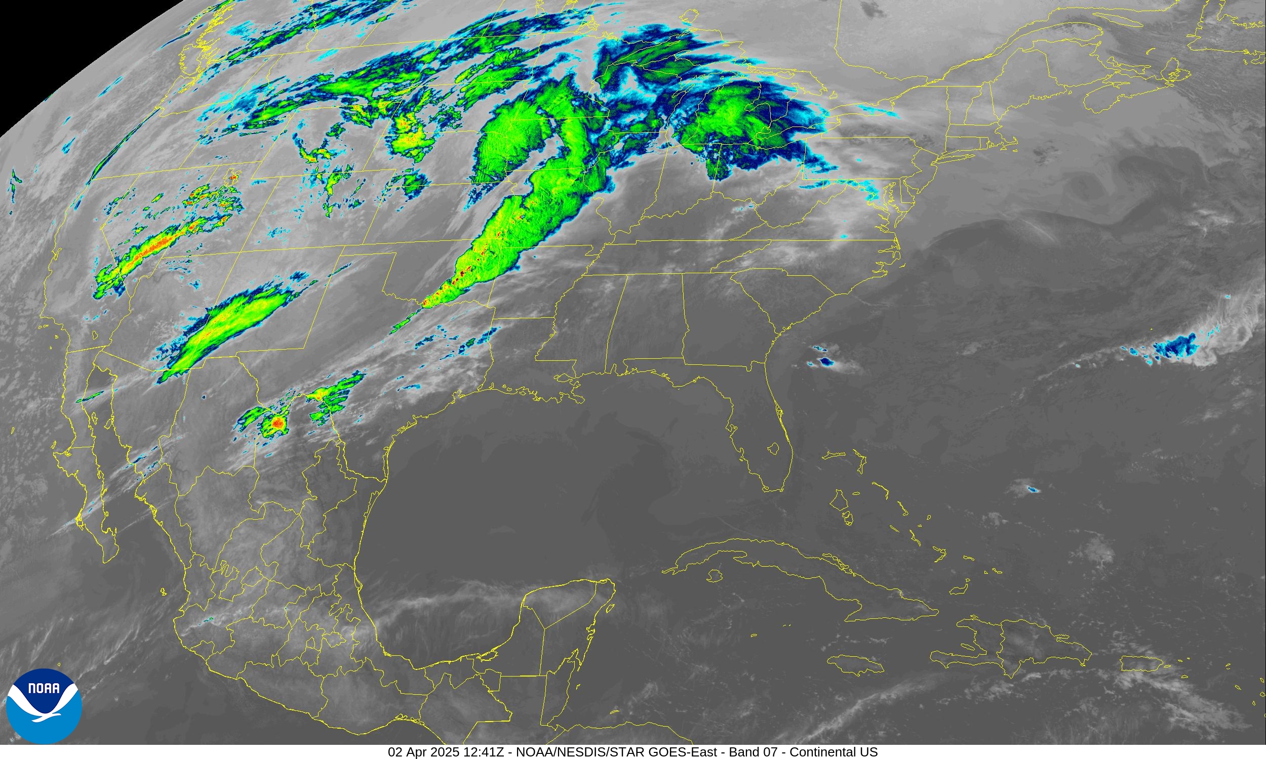
COLLEGE PARK, MD — A powerful and slow-moving spring storm system is set to deliver life-threatening weather across multiple regions of the United States through Friday, with the Lower Ohio Valley and Mid-South facing what forecasters are calling a potentially historic flash flood and tornado outbreak beginning Wednesday.
The National Weather Service warns of a “life-threatening, potentially historic flash flood event” beginning Wednesday, fueled by intense thunderstorms and deep moisture pulled from the Gulf of Mexico. A nearly stationary cold front, bolstered by upper-level atmospheric ridging to the east, will produce repeated rounds of torrential rainfall across the Mid-South, Lower Ohio Valley, and ArkLaTex region. Up to 15 inches of rain is forecast through the weekend, with a 40–60% chance of more than 6 inches falling by Friday.
“This event will bring potentially historic amounts of rainfall,” the Weather Prediction Center said.
At the same time, the Storm Prediction Center has issued a High Risk (Level 5 of 5) for severe weather across parts of the Mid-South, warning of a significant tornado outbreak, including the potential for multiple intense tornadoes. Very large hail and damaging winds are also expected in the broader region stretching from the Great Lakes to the Southern Plains.
The overlapping threats of tornadoes and flooding have led to Moderate to High Risks of Excessive Rainfall for Wednesday and Thursday, with the greatest concern centered on western Kentucky, the Missouri Bootheel, northern Tennessee, and northeastern Arkansas. Saturated soils and slow-moving storms will heighten the flood danger each day.
Winter weather remains active across the Northern Plains and Upper Midwest, where a late-season storm is dropping 4 to 8 inches of snow from the eastern Dakotas to northern Minnesota. Gusty winds could lead to blowing snow and hazardous travel. A mix of sleet, snow, and freezing rain is forecast for parts of northern Wisconsin and Michigan through Wednesday morning, while interior parts of New England may also see light snow and ice accumulations.
In the western U.S., a persistent upper-level trough continues to produce unsettled weather, with snow possible across the Pacific Northwest, Rockies, and Four Corners region. A cold front will intensify snowfall in the northern Rockies and adjacent High Plains into Thursday.
Fire weather also remains a concern in the central and southern High Plains and parts of the Southwest, where Critical Risk (Level 2 of 3) conditions are forecast due to low humidity and strong winds.
Temperature contrasts remain sharp across the country, with highs soaring into the 80s and 90s from the Southern Plains to the Southeast, while much of the West stays cool, with highs in the 40s and 50s in many areas.
Key Points
- High Risk tornado outbreak and flash flooding forecast Wednesday for the Mid-South and Lower Ohio Valley.
- 10–15+ inches of rain possible through the weekend; major flood disruptions expected.
- Heavy snow, ice, and gusty winds continue for the Northern Plains and Upper Midwest.

