TOMS RIVER, NJ – Redeveloping Downtown Toms River has been on the agenda of township leaders and planners since the town was founded. Throughout the centuries, some projects have worked, and others have not. In 1979, then Dover Township planners published a Toms River Waterfront Plan that laid the groundwork for the future of the downtown village area.
Most of what was presented in that plan never happened.
Building ten-story apartment buildings is nothing new for downtown Toms River. In the 1970s, a plan similar to former Mayor Maurice Hill’s plan for a ten-story tower was proposed. Like Mo Hill’s plan, it was fiercely opposed by the locals and never built. Instead, the previously proposed ten-story tower was built as the Riverview Pointe waterfront condominium complex.

As history appears to be repeating itself, Mo Hill’s high-density project is also in jeopardy.
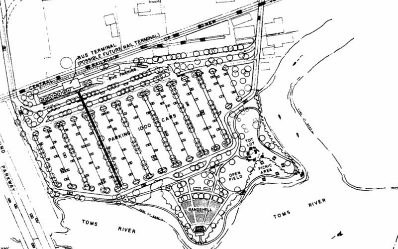
But, in 1979 township planners had a different plan in mind. They wanted to turn the entire waterfront of Toms River into a natural park with sidewalks, benches, and passive recreation, turning the entire waterfront flood plain into a beautiful park anchored on one side by Huddy Park and the other by a park featuring a huge band shell just south the existing Park and Ride.
The proposed park area between the River and the Park and Ride area would have consisted of approximately 8 acres. The park area would include potential waterfront picnic areas, a portion of the hiking and bicycle path, a tot lot, and the development of a permanent municipal band shell.

This facility would be integrated with the Park and Ride facility to provide multiple use of the site during weekends, evenings and holidays. The park area could also serve as a canoe staging area and bicycle and pedestrian staging area access point. Inherent in the proposed park would be preserving and enhancing the existing river’s edge vegetation. Additional bank stabilization and protection would be required along portions of the waterfront area.
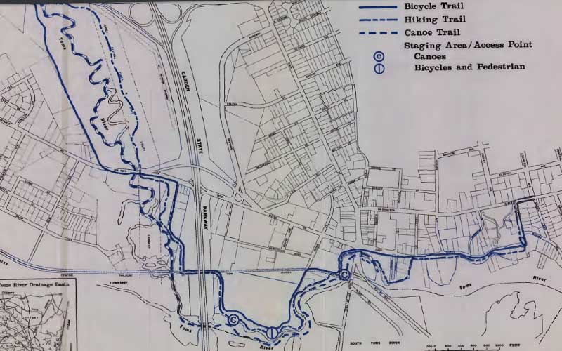
The bike and walking trail would allow residents to walk from the Park and Ride terminal all the way to Huddy Park with unobstructed waterfront views. An even bigger vision proposed extending Winding River Park South trails to connect with the new park systems along the Toms River waterfront.
“The extensive network of public hiking, bicycling, and canoe trails created in t·\Tinding River Park should be extended several additional miles along the waterfront. The proposed hiking and cycling trails will utilize existing highway and utility right-of-way corridors, as well as existing drift roads, throughout much of their length, thereby facilitating construction and minimizing environmental disruption. They will provide linear pathways roughly parallelling the Toms River from Route 37 to the eastern terminus of East Water Street. Rest areas enroute are contemplated as part of this system. Canoe trails, created by desnagging the Toms River where required, will enable canoeists to launch their canoes from an existing site in Riverwood Park or either of the two (2) canoe rental/launch facilities under construction in Winding River Park, and travel an additional 2-1/2+ miles from Route 37 to Huddy Park. A canoe drop-off facTlity is contemplated for construction in Huddy Park,” the 1979 plan stated.

Ironically, the 1979 plan looked more like current Mayor Dan Rodrick’s plan for Downtown Toms River and less like former Mayor Hill’s plan to build apartments on every available square inch of open land.
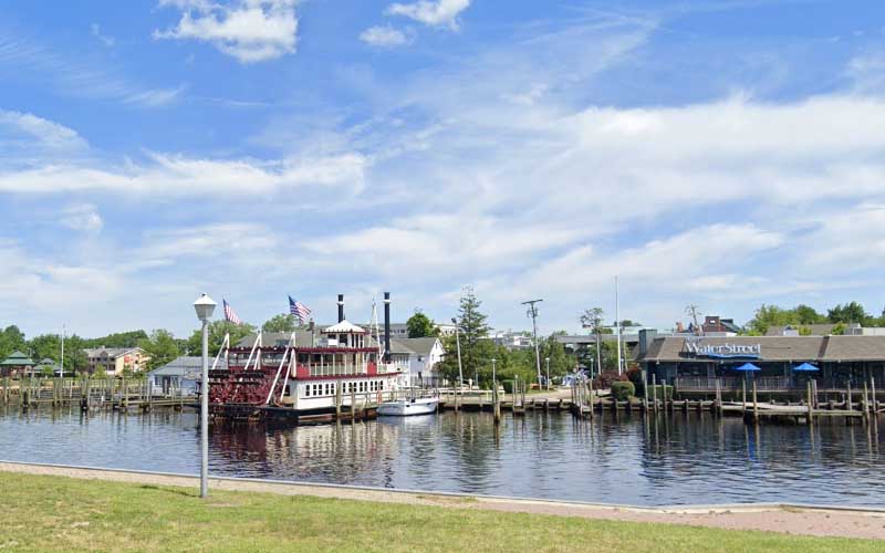
“Acquisition of the designated Seaport Area along the waterfront at Dock Street is recommended. This area is a historical area which once served as a dock for sailing craft in the 1800’s. The lineal open space along the waterfront would provide for protection of one of the prime vistas remaining along this segment of the Toms River and would also provide a natural/historical focal point for displaying marine artifacts and historic boatcraft of the Toms River and Barnegat Bay area,” the 1979 plan says. “Commercial development areas are indicated on the Waterfront Plan at two (2) locations: An existing area along Robbins Parkway and a future location adjacent to the proposed Park and Ride area. These areas are recommended for waterfront related commercial activities including restaurants, gallerys, etc. Through its ability to waive specific requirements for proposed developments within the downtown area, the Dover Township Planning Board can encourage compatible uses, architectural design and circulation patterns. Emphasis on marina and/or historic colonial waterfront structural design is recommended.”
“The marina/boat docks area designated at the foot of Allen Street along the waterfront is recommended for future use and development as an outdoor display area for marina artifacts and, through dredging and decking, of an in-water docking facility and viewing deck for historic river and bay vessels. This area would complement the Seaport Society headquarters and planned museum across Water Street. A commercial marina and historic boat works at the foot of Robbins Parkway (Toms River Boatworks) has been included as a commercial land use. In the event that the boatworks use should terminate, it is recommended that this site be encouraged for restoration/ historic preservation and reuse for a compatible commercial/ marina type use such as a restaurant/gift shop,” the plan continued.

