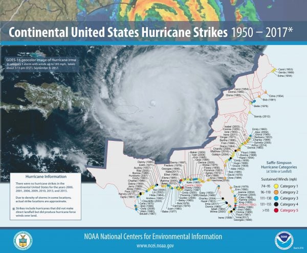
It’s hurricane season and what better way to get you ready for it than by showing you where every hurricane since 1950 that struck the mainland United States made landfall. Now, the National Weather Service has released a map showing every hurricane between 1950 and 2017. Most hit by Hurricanes are the Gulf Coast and Florida, followed by the Carolinas. Here in New Jersey, Sandy was the only major storm to make landfall, and right here in our own backyard in Ocean County.


